


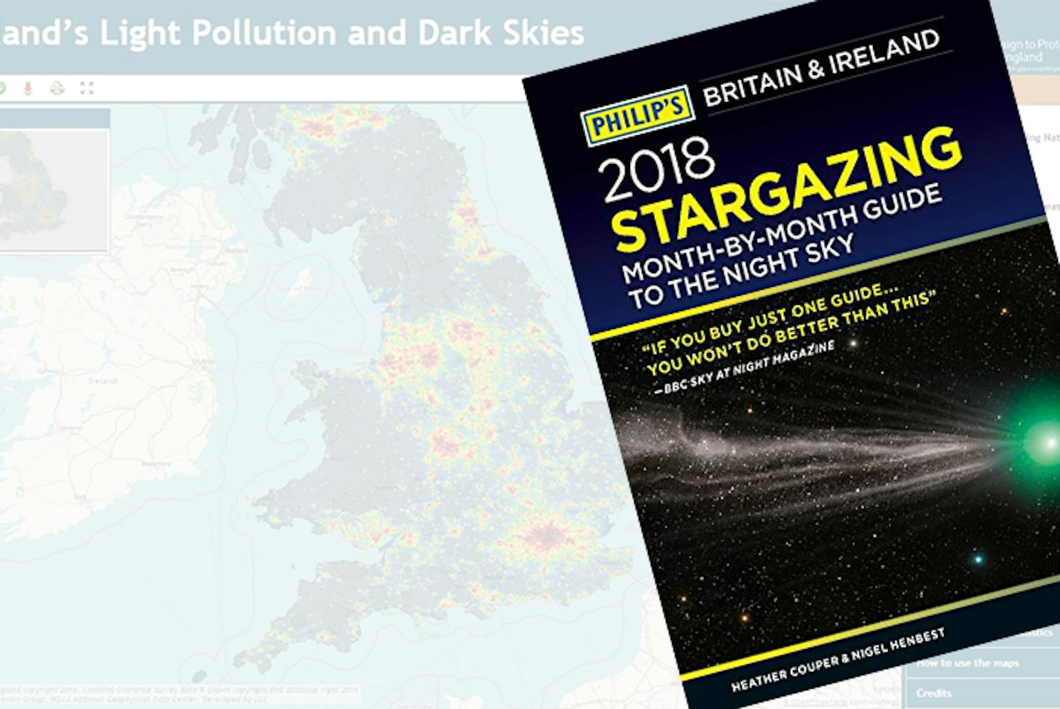
LUC featured in Philip’s 2018 Stargazing Guide
The Philip’s 2018 Stargazing Guide, which is a fantastic resource for amateur astronomers, has just been published and this year’s edition contains a section on dark skies and light pollution featuring the Night Blight maps produced by LUC.
We worked alongside CPRE, using the latest available satellite data to map England’s light pollution and dark skies. The mapping work builds on previous studies undertaken by LUC and CPRE in 2003 to show the extent of light pollution in the UK in 1993 and 2000.
Our GIS team used data gathered by the United States National Oceanic and Atmospheric Administration (NOAA) Suomi NPP satellite to create an interactive map and supporting analysis to show how light pollution is distributed around the country and where the darkest skies are.
LUC’s G&V team has further developed their expertise in this area by expanding our day time photomontage work to cover night time photomontages.
Our visualisation specialists have recently undertaken night photography and modelled specific lighting proposals to produce accurate night visuals and animated sequences.
The original Night Blight maps can be accessed here.
Recent news
 News, 23 April 2024
LUC to exhibit at ISBA Annual Conference, supporting independent schools
LUC recently developed an in-depth masterplan for the Tarbet Visitor Centre project, which will be featured on BBC Scotland's Landward at 8:30 pm on Thursday. The episode is part of a special series on Scotland's national parks, hosted by Dougie Vipond.
LinkedIn, 23 April 2024 News, 20 March 2024
National Trust unveils 8 Hills Regional Park Spatial Framework completed by LUC