


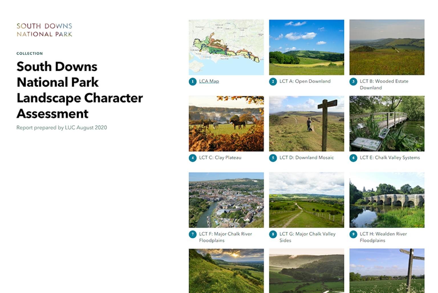
South Downs National Park Digital Landscape Character Assessment published
LUC’s work on a truly digital Landscape Character Assessment (LCA) for South Downs National Park Authority has been published.
Our Landscape Planning and GIS teams developed the updated LCA using ESRI StoryMap software. This allows the report to be interactive and for users to focus on specific locations and areas of interest.
The project marks a step-change in the level of accessibility of these long and often complex reports, allowing them to be more easily interpreted by end-users and shared more widely.
The web-based platform also has the capability to link together a multitude of resources which can be updated as new data emerges, allowing the LCA to stay relevant and up to date. The LCA takes an image and mapping-based approach to help people better understand the key characteristics of different landscape areas.
Chris Fairbrother, Landscape and Biodiversity Strategy Lead for SDNPA, said: “You have produced a great platform for us, and it is streets ahead of where we were before. I think our desire to make the LCA more accessible and user-friendly has certainly been met. Many thanks to you … for supporting us to deliver our aspirations so well. It is much appreciated.”
LUC has been at the forefront of creating web-based outputs for reports over the past decade. Following excellent feedback on a number of recent StoryMaps in recent months, we’ve been extending this service further for a wider range of projects and clients.
You can view the assessment here.
If digital reports could support your landscape projects, please get in touch with Rebecca Knight or Diana Manson.
Recent news
We’ve made our list and checked it twice, because giving back to nature matters. 🎁 This festive season, we’re sharing our Winter Wonder Plan.
LinkedIn, 9 December 2025 News, 17 November 2025
LUC wins Landscape Institute Award for AELTC Wimbledon Park
 Instagram, 17 November 2025
