Night Blight: Mapping England’s Light Pollution and Dark Skies
About the project
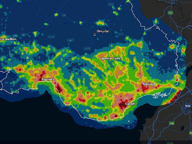
CPRE came to LUC to map England’s light pollution and dark skies. We used the latest available satellite data to build on our 2003 study for CPRE which compared the extent of light pollution in the UK in 1993 and 2000.
Our GIS team used data gathered by the United States National Oceanic and Atmospheric Administration (NOAA) Suomi NPP satellite to create an interactive map and supporting analysis to show how light pollution is distributed around the country and where the darkest skies are. Within the interactive map, users can zoom in to postcode level as well as add contextual layers to aid interpretation. We created PDF maps with summary statistics for each local authority, county, region, designated landscape and National Character Area.
There has been significant interest in the maps and research, including local authorities who are actively using the data to develop lighting policies, as well as to support Sustainability Appraisal and in Landscape Character Assessment.